Real-Time
Positioning & Data Communications Worldwide
 What
is it and who needs it?
The StarFire™ Network is a global system for the distribution of
differential GPS corrections and two-way messaging. Worldwide coverage
means uninterrupted reliability and unprecedented accuracy of better
than 1 foot!
Benefits
of a system, which provide extreme positioning accuracy, coupled with
the capability of allowing remote access to user equipment for control
messages such as instant messaging, or activation/deactivation of a
particular unit are vast. As new applications are continually discovered,
the types of businesses who are currently benefiting from this technology
include, to name a few, vehicle & asset tracking, marine survey,
GIS mapping, precision agriculture and offshore mineral exploration.
How
does it work?
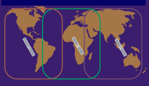
The system utilizes the GPS satellite system, L-band communication satellites,
and a worldwide network of reference stations to deliver real-time high
precision positioning and two-way messaging.
TOP
 The
system requires as its basis a source of DGPS corrections.
GPS satellites transmit raw positioning data. This data is received
by users equipped with our precision GPS receiver at the same time
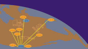
it is received at our Ground Reference Network station locations (GRNs).
This raw GPS measurement data is sent from the GRNs to our Central
Processing Center & Communications HUB. At the Processing Center,
our proprietary differential processing technique, WCT or Wide Area
Correction Transform, is applied and differential corrections are
determined.
 Establishing
the differential corrections is just the first part.
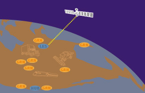
From our co-located Communications HUB, the differential corrections
and any individually targeted data messages are then sent to the LES
(Land Earth Station) for uplink to an L-band communications satellite.
(Designed for maximum flexibility, the StarFire™ system operates,
at present, on both the AMSC and INMARSAT communication satellite
networks, and others may be added in the future, allowing us to take
full advantage of satellites offering the optimum cost and coverage
for a specific geographic area.)
 Unprecedented
real-time position accuracy & data messages can now be received.
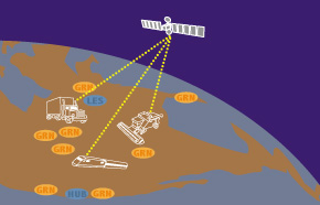
Our communication and correction data are now broadcast via the L-band
communication satellites at which point all information is received
by the end user in real-time!
TOP
How
reliable is the StarFire™ Network?
The entire system is fully redundant and has an uptime of 99.9%! To
achieve this, every stage in the process has a built-in back-up system.
To ensure overall system integrity, a GPS monitor receiver is placed
at each GRN or ground reference station. Data from this integrity monitor
is passed to the communications hub where it is used to independently
monitor the overall accuracy and operation of the system. If for any
reason, a GRN station is determined to be giving inaccurate data, the
‘automatic failure detect’ alerts the Communications HUB where immediate
response and corrections occur.
In
addition, all terrestrial data networks are redundant which means there
are at least two land-based networks transmitting all data simultaneously
to the Central & Redundant Processing Centers & Communications
HUBs. The LES receives all data simultaneously from the Central &
Redundant HUBs.
What
equipment does the end-user need?
Along with subscription service, the singular piece of equipment needed
in order to utilize the system is the StarFire receiver!
The
StarFire receiver
is a combined communications and navigation unit, which includes a GPS
receiver and an L-band transceiver integrated through a system processor
as one unit. As the L-band transmission is received and decoded, the
messages are passed along for display or to control communication actions.
Simultaneously, the differential corrections are passed to the internal
GPS receiver to determine precise position.
For
Product Service inquiries contact Sales.
TOP


